Wednesday, October 27, 2010

Prairie Creek

Prairie Creek is a dark, mossy, foreboding, silent, and beauteous place. Connecting (allegedly) Newnan's Lake with Camps Canal and thus River Styx and Orange Lake, it has attracted and frightened me from the beginning. Wetlands Scientist Friend (a man not given to hyperbole) warned me a while back that this was a place where water moccasins drop into your boat. With web-laden branches that hang two feet off the water in places, I could easily see how this could happen. In fact, the first thing I saw when entering the creek from Newnan's was a water moccasin sunning itself on a cypress strut (more on that later). This is not a place where you want to run aground.

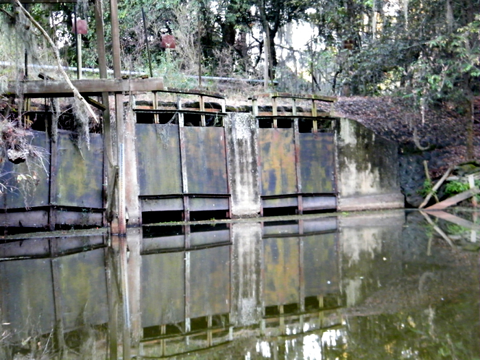
The part of Prairie Creek that had always scared me the most was the Second Bridge. The first bridge is tall and holds Hawthorne Road above the creek. The second bridge is much smaller and supports the Gainesville-Hawthorne trail--and is much closer to the water, as in scraping-up-against-mud-dauber-wasp-nests closer. Thanks to a ornery mood before putting in, and near-record-low water levels, I was ready to shoot the gap, which I did without incident.

Prairie Creek on the other side of this bridge is another world altogether. The water goes from a milky jade to a cesspool brown. The creek itself narrows and become cluttered with tree falls and detritus. This paddler felt like he was entering the Heart of Darkness right there in Payne's Prairie. There was more to discover downstream, but after about 1/2 mile I turned around and headed back.

You will have to trust me when I say the picture above is of a water moccasin. I thought I had captured it but apparently my boat was about to collide with the selfsame tree said moccasin was chilling in. Hence, the shot of the water and the starboard side of my boat. One of the many scary things about water moccasins is they blend in so well with their surroundings. This one was akistrodon piscivorus conanti, the species associated with this area, and it looked like a muddy, muscle-bound walking stick. But the pit viper head was unmistakable. I want to go back and get a better shot of it.

Paddling back out into a uncharacteristically calm Newnan's was like walking into my own living room after an especially scary dream. The breeze can only be described as sweet and, as I was paying close attention, scented with the cypress that rings the lake. This is home.


Sunday, October 24, 2010

Horsetooth Reservoir, Ft. Collins, Colorado

I'll start this one from the end. As I was de-boating back at the ramp, I stepped into knee-deep, wet, sandstone clay, fell over, and dropped my camera onto the concrete ramp. It managed three awful bounces before it came to rest near the water. I'm getting a "zoom error" now and I fear it may be the end of my camera. Had this happened pre-paddle, I would be distraught right now, but I got all the shots, and who knows it may work again, but most cameras aren't designed to bounce.


Navigating Horsetooth was entirely pleasant. The weather was everything yesterday's was not: sunny, clear, breezy and I could see for miles. Miles before I approached Horsetooth, I could tell it used to be a sandstone canyon, now a reservoir, thanks to the damming of four separate rivers. Although this knowledge haunted me the whole time, I was able to get to the place I like to get to when I paddle--a lazy, timeless, meandering state of mind.


The sound of cold lake water sounds different against the paddle than the warm water back home. And cold it was. I ran my hand along the boat and the water ran down my sleeve and stayed cold. Yet it was warm enough that, an hour in, I had to take off my jacket and paddle in my t-shirt. When the sun disappeared behind the clouds later, the temperature dropped 20 degrees.


I wandered into one of the many inlets and pulled up to hike up the hill and listen to the wind blowing through the cottonwoods. Canadian geese and wood ducks were resting nearby, clearly acclimated to the presence of human beings (houses lined this part of the reservoir). All of Colorado is under a long-term drought and evidence was everywhere of the effects here. The level was at least 30 feet lower than it was supposed to be. For a reservoir 200 feet deep, though, it had some room to spare.


I spoke to some fishermen on the way back, who asked me if I were fishing from my kayak. I wasn't, as the hotel does not come equipped with a stove or grill, but the very suggestion made me hungry, and someday I would like to catch my dinner from my boat back home, which is where I am headed now.

Saturday, October 23, 2010

Dillon Reservoir, Colorado

Just getting here turned out to be the riskiest part of this outing. Front Range weather has always been schizoid. I've seen afternoon snow in June in Denver on the same day I wore shirt sleeves in the morning. In this case, it was 60 degrees in Denver, but by the time I headed up Route 40 to Grady Lake, the temp had dropped to 28 and snow and ice covered the entire road. I knew I had 5 miles of switchbacks ahead of me, so this Florida boy turned around and headed back down to Dillon, my Plan B. Just as bad if not worse. Cars all over the road and shoulders. But I had no choice but to push ahead to Dillon, as there were no exits until then.


I got there, got my boat checked at the ramp (they have an invasive mussel issue here), and slid uncomfortably into a strange boat. I felt like I was cheating on Big Blue. This one liked to pitch and most of the paddling was actually correcting the bizarre current and chop on this lake. Oh, and it was freezing cold and windy. Falling into this water would have literally been a matter of life and death. On my way out into the lake, I passed a large sailboat. The man at the wheel said "Great day, isn't it?" He wasn't kidding and I had to agree. A day spent on the water, in radical acceptance of the elements, is a good day indeed.


I've studied the DeLorme, combed every website I could find, and have now paddled some of it. I can go ahead and claim that Florida is much better for flatwater paddling than Colorado--and it's not even close. A dry state, Colorado does not have a plethora of natural lakes. It has rivers, but those are dry much of the time. Paddlers here concentrate on whitewater kayaking almost exclusively. That's fine, but for my meditative needs, the daredevil stuff falls short. 


Nevertheless, I plan to hit it again tomorrow and hope to have more visibility and calmness.

Sunday, October 17, 2010

Lake George at Silver Glen Springs

I've lived in Florida for 22 years and had never seen Lake George (second in size only to Lake Okeechobee, which I have also never seen). So thanks to a little extra weekend driving time, I am no longer a Lake George virgin. It was an experience as big as its size. I write this a spent man, burned and exhausted.


The far shore on Lae George is so distant that to these aging eyes it might well have been the water horizon itself. In fact, everything about Lake George seems a mix of salt water and fresh water: the sandy bottom, the abundant palms on shore, the chop. The water itself is surprisingly clear, with visibility up to three feet or so, and made for a show the whole way. Occasionally, beside me I would see a large disturbance in the water and would look over, hoping to see what gators do when they are trying to get away, but I saw nothing but the churned up bottom.


It took a half mile's paddle past a flotilla of yachts and leather-skinned dowagers to actually get from the springs to the lake. The springs is the clearest water I've ever put my boat in, schools of mullet streaming past underneath, many of them jumping two feet out of the water. Finding where the lake proper begins is obvious, as the water goes from glass smooth to choppy immediately.


I found myself haunted the whole time by descriptions of two of the areas great chroniclers William Bartram and Majorie Kinnan Rawlings (the setting for The Yearling is right where I put in.) Minus the McMansion boats and buoys, Lake George remains exactly as they described it. Bartram especially waxed poetic about his desire to stay and continue to discover this bounty, and I confess I felt the same. I wanted to spend however long it took to investigate every inch of this shoreline, no small task on a lake 12 miles long and 6 miles wide.


The caterpillars have claimed a good piece of the shoreline I did visit, as many of the trees were completely sprayed in webbing. As I recall from my childhood, this does not kill the trees, but something looked out of kilter about it. Perhaps the caterpillar/butterfly has lost a natural predator?


I will come back here, that is for certain, but it will need to be for days, not hours. At the National Park store in Salt Springs, I bought a detailed map of the Ocala National Forest and the paddling options are so numerous that I lost count. It is also one of the few places left in Florida where one can legitimately get lost in the wilderness. Oh, what a joy that would be. Seriously.

Wednesday, October 13, 2010

Newnan's Lake - Northwest

As I've intimated before, Newnan's has different personalities depending on where you put in. The NW quadrant is only part I had not visited, so I jumped at a friend's offer to put in at his place and had anticipated it for weeks. So by the time I pulled up his yard, there was nothing that was going to stop me from getting into the lake--including 20 yards of thick, scratchy vegetation that I had to will myself through. I have no idea what it is, but ants and at least five different species of spider absolutely love it. I am still picking dried bits of it out of my hair as I write this.


By the time I broke on through to the other side--bravely trailblazing a path for my paddling companions--I saw that this part of Newnan's displayed its lower levels more than any other. Barrier tussocks line the entire NW edge and we mostly stayed between them and shore, as the sun was still fierce at 530PM. Dead hydrilla lined the surface in clumps, and we were greeted by a strange array of trash, some of apparently freed from decades long bondage. I grabbed a floating Coke can with a pull tab, something I had not seen since the late '80s.


On the north shore, the lake changed once again, as the water cleared and the tussocks became less prominent. We found a creek that I haven't been able to locate on any map and paddled into its dark canopy. My friend's canoe drew too much water to make it very far, but I was able to progress down a few hundred yards or so until fallen trees prevented further exploration. My wetlands scientist friend has told me tales of snakes dropping into boats in places like these, and I must admit I would have welcomed such drama. As I told him, the more I paddle, the more wilderness I crave.


We took the open lake back to where we entered, which was thankfully next to a gathering of lily pads, else we probably wouldn't have found it before dark. The sun blinded us to everything above the surface, but not to the occasional gator bubble trails. I've been told that Newnan's gators have adapted to the hunters, staying farther offshore than they are accustomed to take advantage of the numerous avenues of escape that open water provides. In fact, we saw none between the shore and the tussocks, only on the open water.


Most jets taking off from and landing at Gainesville Regional Airport bank over Newnan's, and we saw several (some of which I mistaked for airboats). I wonder if they can see us there below tooling around, noticing how Great Blue Herons are loners and ibises always travel in twos.

Tuesday, October 12, 2010

Camps Canal to Prairie Creek

Camps Canal was constructed in 1927 to divert water from Prairie Creek into Orange Lake. Theoretically, waterways do exist from Newnan's to Prairie Creek to Camps Canal to River Styx to Orange Lake, but getting from lake to lake in a kayak would be a superhuman feat at this point. So I consider these forays down Camps and Prairie Creek to be research to find the North Central Florida equivalent of the Northwest Passage. This time I was committed to paddling the Prairie Creek end of the Canal until I could go no farther.


I have yet to head down Camps Canal without observing alligator behavior that I haven't elsewhere. This time a gator big enough to create a large wake even when it was under water pulled out in front of my boat and swam in front of it for 100 yards or so. Even when it submerged, it continued in front of me (and, guess what, a gator can outpaddle anyone) and seemed to refuse to let me pass. I would have happily done this the whole way down the canal, but it required all my concentration. Eventually, I splashed my paddle and it pulled to the side, submerged, and let me pass. Later, at the end of the canal, I paddled into the low canopy among the cypress knees to see if it cleared up ahead and another, smaller gator appeared and swam rapidly right for me. Another day perhaps.


About halfway down, I heard the first sound of Fall in the form of a Sandhill Crane in the prairie off my port bow. For adults in this area, this sound is the equivalent of an ice cream truck's calliope. It brings them running outdoors to find its source. For me, there is no finer sound in nature.


Update on "Harassed on Newnan's": Yesterday, as I was getting ready to leave the Orange Lake ramp at MKR, I saw a man standing next to the same truck I spotted at Newnan's that day. I went up and introduced myself and was able to apologize to him face-to-face for misjudging his intentions and writing about it. He could not have been nicer. I chatted with him for about 15 minutes and learned more in that time about invasive species than I ever knew before. It sucks that I had to make a friend by shooting first and asking questions later, but what are you gonna do if you're me?


Saturday, October 9, 2010

Alto-Santa Fe Canal

The last time I pointed my boat down this canal, it looked to be more trouble than it was worth, especially near sundown. It appeared to be overgrown and thick with ominous shadows. So it was that I was expecting a good, old-fashioned bushwhacking expedition today when I paddled it with some friends. We even brought along a chainsaw and some clippers, but we never got to use these, because the canal is completely navigable all the way through to Little Lake Santa Fe.


First you have to plow through a long carpet of duckweed, but this was no impediment and it felt as if we were paddling across a football field. About a mile down, as we passed under the surprisingly huge bridge at CR1471, we detected the trademark stench of carrion, along with the largest flock of turkey vultures I have ever seen. Whatever it was, we knew from its smell it had to be bigger than a possum. After the trip we hiked a short way through the woods to find out what it was and saw what appeared to be a large deer skeleton.


Water birds love this canal, situated as it is between one largish and two extra large lakes. We were never out of sight of a heron or anhinga. I also had my first sighting of a tri-colored heron. When we broke through to Little Lake Santa Fe we were greeted by a man on a Jet Ski asking about alligators, of which we saw exactly zero. The canal appears well used, as folks before us had clearly done the clearing of it that we came to do.


I love that this canal exists, and it has apparently since 1881. Back then it was wide enough to accommodate steamboats and to encourage commerce between the two lakes. To this day, there remains a world of difference between the two lake communities. Lake Santa Fe is the location of choice for the well-heeled lake dweller, and Alto serves Waldo, a town that after 22 years of living in the area I am still unable to define.


I'm still trying to convince these guys to satisfy our bushwhacking jones on the River Styx, where I know we will have some cutting to do.


Thursday, October 7, 2010

Harassed on Newnan's?

I wasn't even going to write about this outing. I had done it before and this trip was blissfully uneventful. I did finally notice that Red-winged Blackbirds love bullrush, but that wasn't going to be enough of the good stuff for a blog entry.


That is, until the very end. I had drifted about a quarter of mile offshore and was turning around to locate the canal and head back to the truck. From far off I heard an airboat--the only one on the lake this morning (alligator season is over)--and eventually I saw it. It seemed to be headed right for me, but it was too far away to tell. As I got closer to the canal, the boat corrected its trajectory to where I was paddling. Now in the sunlight, you can pick up Big Blue from a long way off, so there was no doubt he saw me.


Before I knew it he was right up on me. Hyacinth stands line this part of the shore and you have to head between them to get to the canal. The airboat cut through the back of these and was about 25 feet from my port side as I entered the canal. Airboaters wear ear protection for a reason, and I had none. I decided I would not hurry in the least to get back to my truck, so I paddled a few strokes here and there, would drift, look up into the trees, and then paddle again. For the entire length of the canal, this guy stayed about 10 to 15 feet off my stern, juicing his boat just enough to stay that distance back. He followed me all the way up to the dock and then turned around and headed back out to the lake.


Since he had no discernible reason for entering the canal, I can only conclude that he did so to harass me, however "subtly." I am sure he had me pegged as a Quiet Lakes supporter--and I unabashedly am. But I have interacted with numerous airboaters on this lake and others and none of them have behaved like this.


The more I thought about it, the more pissed I got and the more I wanted to let him know that I knew what he was doing. There's still some testosterone rocking around this body after all. So I racked my boat and headed over to the only other place airboats can put in...and there he was pulling up to the dock. I drove up far enough so that he could see my blue boat atop my truck, sat awhile, took some pictures, and eventually left. I have a standing policy never to confront armed men.


I've been paranoid before, as anyone who knows me will attest, but in this case I think I may have a good argument. Nevertheless, I think next week will be a Newnan's week for me and my boat. I plan to be a prominent presence there for a long time, airboats or no airboats.


Update: See comments below from John MacLaren. I'm glad to be wrong about this.

Wednesday, October 6, 2010

Santa Fe River East of I-75

Using the same starting point as yesterday, I went east, under the I-75 bridge, and up a river that bore no resemblance to the one I paddled yesterday. While the river west of I-75 was as knotted as a tangle of hair, the east was broad and imminently navigable and devoid of most of the features that give the west its personality.


Indeed, the element that riveted me to the point of obsession was the steam coming off the river. In some sections, I was unable to see where I was paddling. All my pictures from today have this steam in them somewhere. But nothing prepared me for the section where seemingly random columns of steam twisted straight out of the water. Are there mini-springs down below? Why do they twist like little waterspouts, often six feet or higher into the air? Why, as I approached them, did they disappear? I predict a call or two to my scientist friends on this issue.


Another question I need to pose to them is where do the alligators go when it gets cold? I have not seen one since the weather has turned. In fact, aside from the occasional hawk criss-crossing over the river, the only bird I saw (I heard plenty, however) was a solitary white egret. Is this this a Santa Fe thing or a weather thing? Speaking of which, this coolness has gotten my camping juices flowing. I yearn to disappear down a river soon and camp along its banks for a few days. Any suggestions would be welcomed.

Tuesday, October 5, 2010

Santa Fe River through O'Leno State Park

At my age, it is a relief to know that I can still make myself available for "life lessons." For instance, I learned this today: no matter how fun, small, and "cute" a rapids appears downriver, it can be an absolute bastard upriver. At current levels, at least, the Santa Fe has two of these between I-75 and where the river goes underground. Performing the back-and-forth, vigorous rocking motion know to all kayakers along with liberal use of the paddle as a lever, I managed to make it up the smaller rapids coming back. But after the second, larger rapids pinned me broadside between two rocks, allowing my cockpit to fill quickly with water, I decided there was no way out but to exit the boat and drag it upriver.


This trip was a whole lot more work than I expected. Downriver, the water is constantly draining through this or that suck hole or fissure and the current is anything but consistent. Couple that with the many felled trees that have dropped like so many Lincoln Logs across the river and you've got a workout. On the other hand, I once again found myself exclaiming, "Okay, this is the most beautiful place I've ever seen." Click on the picture to your right here (go ahead). You cannot paddle through a vista like this and not be changed.


The pre-Rise Santa Fe is famously twisty and this part of it absolutely was. At times I would wind my way through a series of switchbacks only to find that I had merely cirumnavigated an island that put me a mere 25 yards or so downriver. I often wondered on the way back if I would get lost or not--which is a strange thing to wonder on a river that flows in only one direction. For such an isolated place, however, I was never completely out of earshot of I-75.


Down near the suckhole, where I took a few revolutions around the whirlpool, I saw four wild turkeys on the wing crossing the river. They were such a surprise to me that I had to call a friend afterwards to verify that turkeys could really fly that gracefully. By the time I made it back to the truck, I was beat up and exhausted, but that was not a bad thing. It is good to have a river beat you up every once and a while.

Monday, October 4, 2010

Santa Fe River at Worthington Springs

My days of paddling in shorts and a t-shirt appear to be over for a while. By the time I put in, the temperature had climbed to 55 and the air was so clear I could see the edges of leaves many yards downriver. All the humidity had been relegated to a puffy mist right over the surface of the river. In fact, the water itself was surprisingly warm.


This part of the Santa Fe is deceptive. It appears to be wide and navigable, but the levels are so low that my boat dragged the bottom the entire time. Even fallen trees of moderate thickness stopped me in mid-paddle...and there were many fallen trees. As portage in 50-degree weather wearing shorts and a t-shirt was not an option, this was a relatively short outing.


My descriptive powers fail to represent the alien beauty of this part of the river. The banks are high and steep and expose the ornate networks of the tree roots that line them. The tannin is so highly concentrated here that the water is black and opaque even when it is 6 inches deep. I saw no animals whatsoever here and only the occasional congregation of water skimmers betrayed that this river supported any life at all.


Yet evidence did exist on the banks and shore in the form of trash. I don't want this to become a refrain in my blog, but if someone is drawn to a river or lake or gulf for whatever reason, why then would this person sully the place that attracted them in the first place? Perhaps I am sensitized to this issue from my years of cleaning up the debris my teenager leaves around my house, but it truly does pollute one's experience in the water. Clearly, a trash bag will now become part of my paddling gear.


Tomorrow: The Santa Fe experiment continues at O'Leno.

Sunday, October 3, 2010

Shell Mound to Deer Island

I am spent. The Gulf will do that. The path we took was only six miles total, but it was a tough six, against the wind, against the current, facing the sun, contending with airboat wakes, paddling into false thruways, and so on. By the time we got back to the truck, I'd had a full day.


Finding islands in the Gulf is tricky when you're sitting a foot off the water. Horizons tend to blend and, as its name suggests, all is horizontal. Thankfully, a paddling couple has lovingly put together an excellent guide with simple maps that makes it nearly impossible to get lost. Deer Island was exactly where they reported it to be.


The island itself is as unspoiled as anything can be in Florida. By our reckoning, only one house exists there and everything has been allowed to grow as it was intended. Nevertheless, when we pulled up to stretch on the beach there, I found an empty gallon wine bottle and an old cup, which I dutifully transported back to the mainland. The only possible excuse for such neglect is if they did indeed thrown down a gallon of wine, then remembering to take it with them was probably too much to expect.


A cool, stiff wind stayed with us the entire time, and strangely it seemed to want to turn my bow out to the Gulf. On the other side, the sun baked from above and, as it reflected off the water, from below. Yes, it was a temperature sammich with me in the middle. I am fried to a fare the well, but it's the kind of exhaustion honestly earned.


Tomorrow: Gonna drive north until I hit the Santa Fe and then I'm gonna put in.